Skip to content
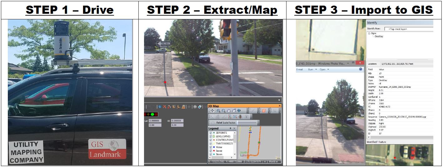
Mobile Mapping Services
Benefits of our mobile mapping services:
- 3D, 360° image coverage
- Captures all visible assets
- Precision Positioning using GNSS and Inertial Measurement Unit.
- Reduced motorist impact and traffic control
- Safe, surveying is done in mobile mapping vehicle
- Accessible data year-round from your desk
- Reduced field-time
- Budget-friendly
- Digitally delivered with measurement capabilities
- Compatible with GIS data systems
- Snip-It Tool for photos
Risks of traditional surveying:
- Expensive
- Takes more manpower
- Inefficient use of time
- Dangerous
- Dependent on weather
- Quick results is impossible
- 2D and cannot capture all features at once
- Incoherent visualization and localization
- Delayed decision making